
Filter
- All Items
- 2026valentine
- accessories
- accounting
- activitybooks
- adapters
- additionalmathematics
- adult
- agriculturalscience
- airvent
- allinone
- anaesthetics
- anatomy
- artandcraft
- artpaperbooks
- artscraft
- artscrafts
- atlases
- bagslunchtotes
- basicscienceyears1-3
- batteries
- binderpages
- biochemistry
- biology
- block
- bluetooth
- bluetoothspeakers
- buildingandmechanicalengineeringdrawing
- business
- businessheadsets
- cables
- capealevel
- carchargersandaccessories
- cardrivingrecorders
- caribbeanhistory
- caribbeanstudies
- chemistry
- childrensbooks
- clinicalmedicine
- clinicalscienceyears4-5
- communicationstudies
- computeraccessories
- cookbooks
- copyprintbind
- covidsafety
- creativearts:dance
- creativewriting
- csecolevel
- dashboard
- dentistry
- dermatology
- desktopstand
- diagnosticandinstrumentation
- dictionaries
- dictionary
- drama
- drawing
- earlychildhood
- economics
- electricalandelectronicengineeringtechnology
- electricalinstallation
- electronicdocumentpreparationmanagementedpm
- electronicsmediatechitems
- embryology
- english
- englisha
- englishb
- englishlanguage
- englishlanguagearts
- enidblyton
- environmentalscience
- epidemiology
- exampreparation
- exampreparationrevisionguide
- exampreparationrevisionguides
- filefolders
- filesfolders
- flashcards
- flashdrives
- french
- generalreading
- generalscience
- geography
- Gift Card
- giftgames
- giftsgames
- haematology
- handbook
- headsets
- healthandfamilylifeeducation
- histology
- history
- homeeconomics
- humanandsocialbiology
- immunology
- industrialtechnology
- informationtechnology
- integratedscience
- iphone
- iphonelightning
- keyboard
- languagearts
- law
- lightning
- literatureandfiction
- management
- managementofbusiness
- mathematics
- medical
- medicalaccessories
- memory
- micro
- microbiology
- miscellaneous
- modernlanguages
- moralsandvalueseducation
- mouse
- mousepad
- music
- nursing
- obstetricsgynaecology
- officeadministration
- officesupplies
- opthalmology
- orthopaedicsurgery
- otolaryngology
- painting
- paperback
- paperproducts
- pathology
- pediatrics
- personalaccessories
- pharmacology
- pharmacy
- phillip
- phoneholder
- phonescases
- phonescreen
- physicaleducation
- physicaleducationandsport
- physics
- physiology
- powerbanks
- powerstrip
- primary
- principlesofaccounts
- principlesofbusiness
- psychiatry
- publications
- puremathematics
- reading
- referencebooks
- religiousbooks
- religiouseducation
- revisionguides
- schoolsupplies
- schooluniforms
- science
- scrubs
- seasonal
- Secondary (1-3)
- secondary1-3
- secondary4-5
- selfiesticks
- smartchargers
- socialsciences
- socialstudies
- socialstudieshistory
- sociology
- spanish
- speakers
- stationery
- storybooks
- supplies
- surgery
- tag
- tapesadhesives
- tapesandadhesives
- teachersresources
- technicaldrawing
- technologyeducation
- teensyoungadult
- textbook
- textbooks
- theatrearts
- thesaurus
- tracker
- twsheadsets
- typec
- uniforms
- veterinary
- visualandperformingarts
- visualarts
- vocationalstudies
- windshield
- wired
- wireless
- wirelesscharging
- writing
- writingdrawing
Products

{"id":5000872591492,"title":"Caribbean School Atlas Skills Workbook 5ed BY Michael Morrissey","handle":"caribbean-school-atlas-skills-workbook-5ed-by-michael-morrissey","description":"\u003cp\u003eDevelop the skills necessary for a 21st-century learner with this Workbook that meets the new curriculum requirements, covering both Social Studies and Geography.\u003cbr\u003e\u003cbr\u003e- Enhance learning with extension activities for both Social Studies and Geography.\u003cbr\u003e- Develop independent thought, critical thinking and problem solving with a range of activities including games and quizzes.\u003c\/p\u003e\n\u003cp\u003eThe Workbook is suitable for Grades 4-9 and can be used alongside the Hodder Education Caribbean School Atlas.\u003c\/p\u003e","published_at":"2020-06-12T22:39:43-04:00","created_at":"2020-06-12T21:58:15-04:00","vendor":"Hodder","type":"Reference Books - Atlases","tags":["atlases","referencebooks"],"price":9000,"price_min":9000,"price_max":9000,"available":true,"price_varies":false,"compare_at_price":0,"compare_at_price_min":0,"compare_at_price_max":0,"compare_at_price_varies":false,"variants":[{"id":34029303398532,"title":"Default Title","option1":"Default Title","option2":null,"option3":null,"sku":"210000004113","requires_shipping":true,"taxable":false,"featured_image":null,"available":true,"name":"Caribbean School Atlas Skills Workbook 5ed BY Michael Morrissey","public_title":null,"options":["Default Title"],"price":9000,"weight":0,"compare_at_price":0,"inventory_management":"shopify","barcode":"9781510459953","requires_selling_plan":false,"selling_plan_allocations":[],"quantity_rule":{"min":1,"max":null,"increment":1}}],"images":["\/\/www.charrans.com\/cdn\/shop\/products\/03861e21b73102e47da212697a7ba6a7.jpg?v=1724515913"],"featured_image":"\/\/www.charrans.com\/cdn\/shop\/products\/03861e21b73102e47da212697a7ba6a7.jpg?v=1724515913","options":["Title"],"media":[{"alt":null,"id":8454799097988,"position":1,"preview_image":{"aspect_ratio":1.0,"height":650,"width":650,"src":"\/\/www.charrans.com\/cdn\/shop\/products\/03861e21b73102e47da212697a7ba6a7.jpg?v=1724515913"},"aspect_ratio":1.0,"height":650,"media_type":"image","src":"\/\/www.charrans.com\/cdn\/shop\/products\/03861e21b73102e47da212697a7ba6a7.jpg?v=1724515913","width":650}],"requires_selling_plan":false,"selling_plan_groups":[],"content":"\u003cp\u003eDevelop the skills necessary for a 21st-century learner with this Workbook that meets the new curriculum requirements, covering both Social Studies and Geography.\u003cbr\u003e\u003cbr\u003e- Enhance learning with extension activities for both Social Studies and Geography.\u003cbr\u003e- Develop independent thought, critical thinking and problem solving with a range of activities including games and quizzes.\u003c\/p\u003e\n\u003cp\u003eThe Workbook is suitable for Grades 4-9 and can be used alongside the Hodder Education Caribbean School Atlas.\u003c\/p\u003e"}
You may also like:
Caribbean School Atlas Skills Workbook 5ed BY Michael Morrissey
$90.00
Develop the skills necessary for a 21st-century learner with this Workbook that meets the new curriculum requirements, covering both Social...

{"id":7112320712836,"title":"Collins First Atlas Age 4+, 3ed BY Collins Maps","handle":"collins-first-atlas-2ed-by-collins-maps-1","description":"\u003cp\u003eThe must-have atlas for children aged 4-7\u003c\/p\u003e\n\u003cp\u003eCollins First Atlas is a fun, vibrant and clear starter atlas for children aged 4-7 years, providing the perfect foundation to basic geography skills.\u003c\/p\u003e\n\u003cp\u003eThe atlas begins by introducing pupils to photographs and mapping of a local area, then gradually leads them through maps of regional, national, continental and global areas.\u003c\/p\u003e","published_at":"2023-05-18T14:33:51-04:00","created_at":"2023-05-18T14:33:51-04:00","vendor":"Collins","type":"Reference Books - Atlases","tags":["atlases","referencebooks"],"price":6900,"price_min":6900,"price_max":6900,"available":true,"price_varies":false,"compare_at_price":0,"compare_at_price_min":0,"compare_at_price_max":0,"compare_at_price_varies":false,"variants":[{"id":41424190668932,"title":"Default Title","option1":"Default Title","option2":null,"option3":null,"sku":"210000008906","requires_shipping":true,"taxable":false,"featured_image":null,"available":true,"name":"Collins First Atlas Age 4+, 3ed BY Collins Maps","public_title":null,"options":["Default Title"],"price":6900,"weight":0,"compare_at_price":0,"inventory_management":"shopify","barcode":"9780008485931","requires_selling_plan":false,"selling_plan_allocations":[],"quantity_rule":{"min":1,"max":null,"increment":1}}],"images":["\/\/www.charrans.com\/cdn\/shop\/files\/04c7d92c33facaeb73978f5e3c809659.jpg?v=1694462855"],"featured_image":"\/\/www.charrans.com\/cdn\/shop\/files\/04c7d92c33facaeb73978f5e3c809659.jpg?v=1694462855","options":["Title"],"media":[{"alt":null,"id":25339200241796,"position":1,"preview_image":{"aspect_ratio":0.771,"height":650,"width":501,"src":"\/\/www.charrans.com\/cdn\/shop\/files\/04c7d92c33facaeb73978f5e3c809659.jpg?v=1694462855"},"aspect_ratio":0.771,"height":650,"media_type":"image","src":"\/\/www.charrans.com\/cdn\/shop\/files\/04c7d92c33facaeb73978f5e3c809659.jpg?v=1694462855","width":501}],"requires_selling_plan":false,"selling_plan_groups":[],"content":"\u003cp\u003eThe must-have atlas for children aged 4-7\u003c\/p\u003e\n\u003cp\u003eCollins First Atlas is a fun, vibrant and clear starter atlas for children aged 4-7 years, providing the perfect foundation to basic geography skills.\u003c\/p\u003e\n\u003cp\u003eThe atlas begins by introducing pupils to photographs and mapping of a local area, then gradually leads them through maps of regional, national, continental and global areas.\u003c\/p\u003e"}
You may also like:
Collins First Atlas Age 4+, 3ed BY Collins Maps
$69.00
The must-have atlas for children aged 4-7 Collins First Atlas is a fun, vibrant and clear starter atlas for children...

{"id":7112326480004,"title":"Collins Primary Atlas, 7ed BY Collins","handle":"collins-primary-atlas-7ed-by-collins","description":null,"published_at":"2023-05-18T15:33:13-04:00","created_at":"2023-05-18T15:33:13-04:00","vendor":"Charrans.com","type":"Reference Books - Atlases","tags":["atlases","referencebooks"],"price":8900,"price_min":8900,"price_max":8900,"available":true,"price_varies":false,"compare_at_price":9200,"compare_at_price_min":9200,"compare_at_price_max":9200,"compare_at_price_varies":false,"variants":[{"id":41424221700228,"title":"Default Title","option1":"Default Title","option2":null,"option3":null,"sku":"210000008909","requires_shipping":true,"taxable":false,"featured_image":null,"available":true,"name":"Collins Primary Atlas, 7ed BY Collins","public_title":null,"options":["Default Title"],"price":8900,"weight":0,"compare_at_price":9200,"inventory_management":"shopify","barcode":"9780008485948","requires_selling_plan":false,"selling_plan_allocations":[],"quantity_rule":{"min":1,"max":null,"increment":1}}],"images":["\/\/www.charrans.com\/cdn\/shop\/files\/3ecf7ef97e2083e21bc621a154c7751e.jpg?v=1693665522"],"featured_image":"\/\/www.charrans.com\/cdn\/shop\/files\/3ecf7ef97e2083e21bc621a154c7751e.jpg?v=1693665522","options":["Title"],"media":[{"alt":null,"id":25567471435908,"position":1,"preview_image":{"aspect_ratio":0.725,"height":650,"width":471,"src":"\/\/www.charrans.com\/cdn\/shop\/files\/3ecf7ef97e2083e21bc621a154c7751e.jpg?v=1693665522"},"aspect_ratio":0.725,"height":650,"media_type":"image","src":"\/\/www.charrans.com\/cdn\/shop\/files\/3ecf7ef97e2083e21bc621a154c7751e.jpg?v=1693665522","width":471}],"requires_selling_plan":false,"selling_plan_groups":[],"content":null}

{"id":7112321859716,"title":"Collins School Atlas, 6ed BY Collins Maps","handle":"collins-school-atlas-5ed-by-collins-maps-1","description":"\u003cp\u003e\u003cstrong\u003eThe must-have atlas for pupils aged 11-14. \u003c\/strong\u003eFully updated for 2022-2023, this world atlas is designed to support Key Stage 3 students aged 11-14 years in developing their geographical and mapping skills. The content follows requirements of the National Curriculum and has been reviewed by educational experts.\u003c\/p\u003e","published_at":"2023-05-18T14:42:34-04:00","created_at":"2023-05-18T14:42:34-04:00","vendor":"Collins","type":"Reference Books - Atlases","tags":["atlases","referencebooks"],"price":11500,"price_min":11500,"price_max":11500,"available":true,"price_varies":false,"compare_at_price":0,"compare_at_price_min":0,"compare_at_price_max":0,"compare_at_price_varies":false,"variants":[{"id":41424199549060,"title":"Default Title","option1":"Default Title","option2":null,"option3":null,"sku":"210000008908","requires_shipping":true,"taxable":false,"featured_image":null,"available":true,"name":"Collins School Atlas, 6ed BY Collins Maps","public_title":null,"options":["Default Title"],"price":11500,"weight":0,"compare_at_price":0,"inventory_management":"shopify","barcode":"9780008485955","requires_selling_plan":false,"selling_plan_allocations":[],"quantity_rule":{"min":1,"max":null,"increment":1}}],"images":["\/\/www.charrans.com\/cdn\/shop\/files\/46b607cd27a12333b7fce0eafc7157dc.jpg?v=1737582274"],"featured_image":"\/\/www.charrans.com\/cdn\/shop\/files\/46b607cd27a12333b7fce0eafc7157dc.jpg?v=1737582274","options":["Title"],"media":[{"alt":null,"id":25567479693444,"position":1,"preview_image":{"aspect_ratio":0.725,"height":650,"width":471,"src":"\/\/www.charrans.com\/cdn\/shop\/files\/46b607cd27a12333b7fce0eafc7157dc.jpg?v=1737582274"},"aspect_ratio":0.725,"height":650,"media_type":"image","src":"\/\/www.charrans.com\/cdn\/shop\/files\/46b607cd27a12333b7fce0eafc7157dc.jpg?v=1737582274","width":471}],"requires_selling_plan":false,"selling_plan_groups":[],"content":"\u003cp\u003e\u003cstrong\u003eThe must-have atlas for pupils aged 11-14. \u003c\/strong\u003eFully updated for 2022-2023, this world atlas is designed to support Key Stage 3 students aged 11-14 years in developing their geographical and mapping skills. The content follows requirements of the National Curriculum and has been reviewed by educational experts.\u003c\/p\u003e"}
You may also like:
Collins School Atlas, 6ed BY Collins Maps
$115.00
The must-have atlas for pupils aged 11-14. Fully updated for 2022-2023, this world atlas is designed to support Key Stage...

{"id":5000875180164,"title":"Collins Social Studies Atlas for the Caribbean, BY Collins Maps","handle":"collins-social-studies-atlas-for-the-caribbean-by-collins-maps","description":"\u003cp\u003ePrepared specifically to support social studies and geography courses at upper primary and lower secondary levels throughout the Caribbean. The atlas is fully illustrated and includes the most up to date reference and thematic mapping of the countries within the Caribbean Community as well as the broader Caribbean region. Maps are fully supported with illustrations, photographs and data. World maps cover international issues which have a bearing on Caribbean development.\u003c\/p\u003e","published_at":"2020-06-12T22:39:38-04:00","created_at":"2020-06-12T21:59:19-04:00","vendor":"Collins","type":"Reference Books - Atlases","tags":["atlases","referencebooks"],"price":8900,"price_min":8900,"price_max":8900,"available":true,"price_varies":false,"compare_at_price":0,"compare_at_price_min":0,"compare_at_price_max":0,"compare_at_price_varies":false,"variants":[{"id":34029305987204,"title":"Default Title","option1":"Default Title","option2":null,"option3":null,"sku":"210000004675","requires_shipping":true,"taxable":false,"featured_image":null,"available":true,"name":"Collins Social Studies Atlas for the Caribbean, BY Collins Maps","public_title":null,"options":["Default Title"],"price":8900,"weight":0,"compare_at_price":0,"inventory_management":"shopify","barcode":"9780008152260","requires_selling_plan":false,"selling_plan_allocations":[],"quantity_rule":{"min":1,"max":null,"increment":1}}],"images":["\/\/www.charrans.com\/cdn\/shop\/products\/05edda23c85c3d53a69fbd0aae9eca1a.jpg?v=1724517829"],"featured_image":"\/\/www.charrans.com\/cdn\/shop\/products\/05edda23c85c3d53a69fbd0aae9eca1a.jpg?v=1724517829","options":["Title"],"media":[{"alt":null,"id":8454801883268,"position":1,"preview_image":{"aspect_ratio":1.0,"height":650,"width":650,"src":"\/\/www.charrans.com\/cdn\/shop\/products\/05edda23c85c3d53a69fbd0aae9eca1a.jpg?v=1724517829"},"aspect_ratio":1.0,"height":650,"media_type":"image","src":"\/\/www.charrans.com\/cdn\/shop\/products\/05edda23c85c3d53a69fbd0aae9eca1a.jpg?v=1724517829","width":650}],"requires_selling_plan":false,"selling_plan_groups":[],"content":"\u003cp\u003ePrepared specifically to support social studies and geography courses at upper primary and lower secondary levels throughout the Caribbean. The atlas is fully illustrated and includes the most up to date reference and thematic mapping of the countries within the Caribbean Community as well as the broader Caribbean region. Maps are fully supported with illustrations, photographs and data. World maps cover international issues which have a bearing on Caribbean development.\u003c\/p\u003e"}
You may also like:
Collins Social Studies Atlas for the Caribbean, BY Collins Maps
$89.00
Prepared specifically to support social studies and geography courses at upper primary and lower secondary levels throughout the Caribbean. The...
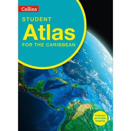
{"id":5000874852484,"title":"Collins Student Atlas for the Caribbean, BY Collins Maps","handle":"collins-student-atlas-for-the-caribbean-by-collins-maps","description":"\u003cp\u003eWith comprehensive coverage of the Caribbean islands, gulfs and bays this atlas focuses on accurate mapping of all the Caribbean countries. Thematic maps of individual countries and the Caribbean region address topics specific to the syllabus. This completely new Collins Carribean Student Atlas is created for the requirements of CSEC Geography students and is a vital tool for all students, with up-to-date reference and thematic mapping, useful statistics and an extensive index. The Atlas has been specifically designed for CSEC students, however its well-researched content and uncluttered design makes it easy for all student use. Topics include population, climate, economy, industry, trade, tourism, history and the environment. All maps are created using the latest statistical information available. High quality satellite imagery, which has been selectively used within the special topic or study areas, supports data on the maps and is used to illustrate key environmental issues. Up-to-date data aids students wishing to create their own graphics to support individual projects.\u003c\/p\u003e","published_at":"2020-06-12T22:39:39-04:00","created_at":"2020-06-12T21:59:09-04:00","vendor":"Collins","type":"Reference Books - Atlases","tags":["atlases","referencebooks"],"price":17200,"price_min":17200,"price_max":17200,"available":false,"price_varies":false,"compare_at_price":0,"compare_at_price_min":0,"compare_at_price_max":0,"compare_at_price_varies":false,"variants":[{"id":34029305659524,"title":"Default Title","option1":"Default Title","option2":null,"option3":null,"sku":"210000004676","requires_shipping":true,"taxable":false,"featured_image":null,"available":false,"name":"Collins Student Atlas for the Caribbean, BY Collins Maps","public_title":null,"options":["Default Title"],"price":17200,"weight":0,"compare_at_price":0,"inventory_management":"shopify","barcode":"9780008214326","requires_selling_plan":false,"selling_plan_allocations":[],"quantity_rule":{"min":1,"max":null,"increment":1}}],"images":["\/\/www.charrans.com\/cdn\/shop\/products\/094feeae08b73822f321a608b12d3b8c.jpg?v=1725047040"],"featured_image":"\/\/www.charrans.com\/cdn\/shop\/products\/094feeae08b73822f321a608b12d3b8c.jpg?v=1725047040","options":["Title"],"media":[{"alt":null,"id":8454801490052,"position":1,"preview_image":{"aspect_ratio":1.0,"height":650,"width":650,"src":"\/\/www.charrans.com\/cdn\/shop\/products\/094feeae08b73822f321a608b12d3b8c.jpg?v=1725047040"},"aspect_ratio":1.0,"height":650,"media_type":"image","src":"\/\/www.charrans.com\/cdn\/shop\/products\/094feeae08b73822f321a608b12d3b8c.jpg?v=1725047040","width":650}],"requires_selling_plan":false,"selling_plan_groups":[],"content":"\u003cp\u003eWith comprehensive coverage of the Caribbean islands, gulfs and bays this atlas focuses on accurate mapping of all the Caribbean countries. Thematic maps of individual countries and the Caribbean region address topics specific to the syllabus. This completely new Collins Carribean Student Atlas is created for the requirements of CSEC Geography students and is a vital tool for all students, with up-to-date reference and thematic mapping, useful statistics and an extensive index. The Atlas has been specifically designed for CSEC students, however its well-researched content and uncluttered design makes it easy for all student use. Topics include population, climate, economy, industry, trade, tourism, history and the environment. All maps are created using the latest statistical information available. High quality satellite imagery, which has been selectively used within the special topic or study areas, supports data on the maps and is used to illustrate key environmental issues. Up-to-date data aids students wishing to create their own graphics to support individual projects.\u003c\/p\u003e"}
You may also like:
Collins Student Atlas for the Caribbean, BY Collins Maps
Sold Out
With comprehensive coverage of the Caribbean islands, gulfs and bays this atlas focuses on accurate mapping of all the Caribbean...
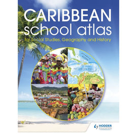
{"id":5000872460420,"title":"Hodder Education (formerly Longman's) Caribbean School Atlas for Social Studies, Geography and History BY Morrissey","handle":"hodder-education-caribbean-school-atlas-by-morrissey","description":"\u003cp\u003eFormerly Longman's Caribbean School Atlas!\u003c\/p\u003e\n\u003cp\u003eFeel confident in full coverage of the curriculum requirements with an atlas specially created to cover Social Studies, Geography and History.\u003c\/p\u003e\n\u003cp\u003e- Encourage awareness of the whole Caribbean region with a 44-page Caribbean section, containing detailed maps of all independent countries and major dependent territories from The Bahamas to Trinidad, and including Belize and Guyana.\u003c\/p\u003e\n\u003cp\u003e- Engage students in topical issues with a world mapping section, including features on world climate, the environment and population.\u003c\/p\u003e\n\u003cp\u003e- Introduce a solid foundation in geographical knowledge with world facts and figures for all nations.\u003c\/p\u003e\n\u003cp\u003e- Secure strong geographical skills with a feature on map reading and how to use an atlas.\u003c\/p\u003e\n\u003cp\u003e- Ensure ease-of-use with a 4-page index showing letter-figure grid references to place names found on the maps.\u003c\/p\u003e","published_at":"2020-06-12T22:39:43-04:00","created_at":"2020-06-12T21:58:12-04:00","vendor":"Hodder","type":"Reference Books - Atlases","tags":["atlases","referencebooks"],"price":12075,"price_min":12075,"price_max":12075,"available":true,"price_varies":false,"compare_at_price":0,"compare_at_price_min":0,"compare_at_price_max":0,"compare_at_price_varies":false,"variants":[{"id":34029303267460,"title":"Default Title","option1":"Default Title","option2":null,"option3":null,"sku":"210000004112","requires_shipping":true,"taxable":false,"featured_image":null,"available":true,"name":"Hodder Education (formerly Longman's) Caribbean School Atlas for Social Studies, Geography and History BY Morrissey","public_title":null,"options":["Default Title"],"price":12075,"weight":0,"compare_at_price":0,"inventory_management":"shopify","barcode":"9781510434660","requires_selling_plan":false,"selling_plan_allocations":[],"quantity_rule":{"min":1,"max":null,"increment":1}}],"images":["\/\/www.charrans.com\/cdn\/shop\/products\/072d77269f333d38f7e99d2b38142691.jpg?v=1725040487"],"featured_image":"\/\/www.charrans.com\/cdn\/shop\/products\/072d77269f333d38f7e99d2b38142691.jpg?v=1725040487","options":["Title"],"media":[{"alt":null,"id":8454799065220,"position":1,"preview_image":{"aspect_ratio":1.0,"height":650,"width":650,"src":"\/\/www.charrans.com\/cdn\/shop\/products\/072d77269f333d38f7e99d2b38142691.jpg?v=1725040487"},"aspect_ratio":1.0,"height":650,"media_type":"image","src":"\/\/www.charrans.com\/cdn\/shop\/products\/072d77269f333d38f7e99d2b38142691.jpg?v=1725040487","width":650}],"requires_selling_plan":false,"selling_plan_groups":[],"content":"\u003cp\u003eFormerly Longman's Caribbean School Atlas!\u003c\/p\u003e\n\u003cp\u003eFeel confident in full coverage of the curriculum requirements with an atlas specially created to cover Social Studies, Geography and History.\u003c\/p\u003e\n\u003cp\u003e- Encourage awareness of the whole Caribbean region with a 44-page Caribbean section, containing detailed maps of all independent countries and major dependent territories from The Bahamas to Trinidad, and including Belize and Guyana.\u003c\/p\u003e\n\u003cp\u003e- Engage students in topical issues with a world mapping section, including features on world climate, the environment and population.\u003c\/p\u003e\n\u003cp\u003e- Introduce a solid foundation in geographical knowledge with world facts and figures for all nations.\u003c\/p\u003e\n\u003cp\u003e- Secure strong geographical skills with a feature on map reading and how to use an atlas.\u003c\/p\u003e\n\u003cp\u003e- Ensure ease-of-use with a 4-page index showing letter-figure grid references to place names found on the maps.\u003c\/p\u003e"}
You may also like:
Hodder Education (formerly Longman's) Caribbean School Atlas for Social Studies, Geography and History BY Morrissey
$120.75
Formerly Longman's Caribbean School Atlas! Feel confident in full coverage of the curriculum requirements with an atlas specially created to...

{"id":7120499245188,"title":"Philips Caribbean Atlas for Secondary Schools, 8ed","handle":"philips-caribbean-atlas-for-secondary-schools-new-for-2023","description":"\u003cp\u003eA new edition of the \u003cstrong\u003emarket-leading atlas for CXC Geography students,\u003c\/strong\u003e\u003cem\u003e Philip’s Caribbean Atlas for Secondary Schools\u003c\/em\u003e provides\u003cstrong\u003e extensive coverage of the Caribbean area,\u003c\/strong\u003e together with a \u003cstrong\u003ecomprehensive selection of world and regional maps.\u003c\/strong\u003e\u003cbr\u003eThe atlas is \u003cstrong\u003earranged in three sections for ease of use\u003c\/strong\u003e, with each page colour-coded for rapid reference. The first section is devoted to a\u003cstrong\u003e detailed coverage of the Caribbean region\u003c\/strong\u003e in 48 pages, and includes maps of every island plus Belize and Guyana, as well as topographical, land use, tourism and mining maps.\u003cbr\u003eThe second section is made up of 72 pages of\u003cstrong\u003e World topographical maps\u003c\/strong\u003e, incorporating continental thematic maps on topics such as population, climate and biomes, followed by 32 pages of World thematic maps. This new 8th edition features updated mapping of all Caribbean islands, as well as the latest statistics. The World map section contains additional coverage of Brazil, the Americas and Asia, while the World thematic section includes maps on volcanoes, El Niño, tourism, energy, minerals, industry, trade and international organizations.\u003cbr\u003e\u003cbr\u003eCompleting the atlas is a \u003cstrong\u003esection of CXC study maps\u003c\/strong\u003e covering topics such as farming, soil conservation, economics, tourism and urban land use. Features regional studies of Mauritius, UK, Canada, USA and Brazil.\u003cbr\u003e\u003cbr\u003eThe index gives letter-figure grid references as well as latitude and longitude co-ordinates.\u003c\/p\u003e","published_at":"2023-06-12T20:39:09-04:00","created_at":"2023-06-12T20:39:10-04:00","vendor":"Hodder","type":"Reference Books - Atlases","tags":["atlases","phillip","referencebooks"],"price":13900,"price_min":13900,"price_max":13900,"available":true,"price_varies":false,"compare_at_price":14900,"compare_at_price_min":14900,"compare_at_price_max":14900,"compare_at_price_varies":false,"variants":[{"id":41448377516164,"title":"Default Title","option1":"Default Title","option2":null,"option3":null,"sku":"210000008948","requires_shipping":true,"taxable":false,"featured_image":null,"available":true,"name":"Philips Caribbean Atlas for Secondary Schools, 8ed","public_title":null,"options":["Default Title"],"price":13900,"weight":0,"compare_at_price":14900,"inventory_management":"shopify","barcode":"9781849076470","requires_selling_plan":false,"selling_plan_allocations":[],"quantity_rule":{"min":1,"max":null,"increment":1}}],"images":["\/\/www.charrans.com\/cdn\/shop\/files\/b36520c93503b2ab5ca81646168d87b7.jpg?v=1737582536"],"featured_image":"\/\/www.charrans.com\/cdn\/shop\/files\/b36520c93503b2ab5ca81646168d87b7.jpg?v=1737582536","options":["Title"],"media":[{"alt":null,"id":25171107446916,"position":1,"preview_image":{"aspect_ratio":0.788,"height":650,"width":512,"src":"\/\/www.charrans.com\/cdn\/shop\/files\/b36520c93503b2ab5ca81646168d87b7.jpg?v=1737582536"},"aspect_ratio":0.788,"height":650,"media_type":"image","src":"\/\/www.charrans.com\/cdn\/shop\/files\/b36520c93503b2ab5ca81646168d87b7.jpg?v=1737582536","width":512}],"requires_selling_plan":false,"selling_plan_groups":[],"content":"\u003cp\u003eA new edition of the \u003cstrong\u003emarket-leading atlas for CXC Geography students,\u003c\/strong\u003e\u003cem\u003e Philip’s Caribbean Atlas for Secondary Schools\u003c\/em\u003e provides\u003cstrong\u003e extensive coverage of the Caribbean area,\u003c\/strong\u003e together with a \u003cstrong\u003ecomprehensive selection of world and regional maps.\u003c\/strong\u003e\u003cbr\u003eThe atlas is \u003cstrong\u003earranged in three sections for ease of use\u003c\/strong\u003e, with each page colour-coded for rapid reference. The first section is devoted to a\u003cstrong\u003e detailed coverage of the Caribbean region\u003c\/strong\u003e in 48 pages, and includes maps of every island plus Belize and Guyana, as well as topographical, land use, tourism and mining maps.\u003cbr\u003eThe second section is made up of 72 pages of\u003cstrong\u003e World topographical maps\u003c\/strong\u003e, incorporating continental thematic maps on topics such as population, climate and biomes, followed by 32 pages of World thematic maps. This new 8th edition features updated mapping of all Caribbean islands, as well as the latest statistics. The World map section contains additional coverage of Brazil, the Americas and Asia, while the World thematic section includes maps on volcanoes, El Niño, tourism, energy, minerals, industry, trade and international organizations.\u003cbr\u003e\u003cbr\u003eCompleting the atlas is a \u003cstrong\u003esection of CXC study maps\u003c\/strong\u003e covering topics such as farming, soil conservation, economics, tourism and urban land use. Features regional studies of Mauritius, UK, Canada, USA and Brazil.\u003cbr\u003e\u003cbr\u003eThe index gives letter-figure grid references as well as latitude and longitude co-ordinates.\u003c\/p\u003e"}
You may also like:
Philips Caribbean Atlas for Secondary Schools, 8ed
$149.00
$139.00
A new edition of the market-leading atlas for CXC Geography students, Philip’s Caribbean Atlas for Secondary Schools provides extensive coverage of the Caribbean area, together...